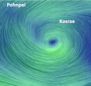
Over the night of Friday 8th May and through Saturday 9th May Tropical Depression Seven is going to pass close to the west of Kosrae. The current wind patterns on Friday evening are shown below.
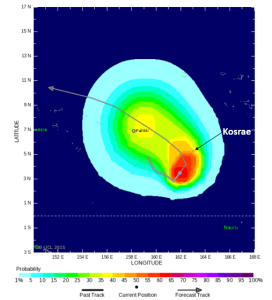
The tropical depression has been tracking east to the south of Kosrae and is forecast to bend north and then head west towards Pohnpei. It is unlikely to increase to a tropical storm until it is well west of Kosrae. There is a medium (up to 50%) chance of winds reaching tropical storm strength (wind speeds of 62-88 km/hr) at Kosrae over the next 48 hours.

Likelihood of tropical storm strength winds over the Friday (8th) and Saturday (9th) May. Sourced from www.tropicalstormrisk.com
Damage is likely to be reasonably minimal typically to only the flimsiest lean-to type structures. Unsecured light signs blown down and unsecured corrugated iron blown about. Minor damage to banana trees and near-coastal agriculture, primarily from salt spray. Some small dead limbs, ripe coconuts, and dead palm fronds blown from trees. Some fragile and tender green leaves blown from trees such as papaya and fleshy broad leaf plants.
Wave conditions are likely to be highest off the south (Utwe) and south-east (Malem coasts. Seas are likely to be rough with higher than normal wave breaking on the fringing reef. Any wave overwash, flooding and damage is likely to occur around high tides which are at 5:47 pm on Friday and 6:04 am on Saturday. High tide levels are not particularly high, currently dropping from the spring tides in the middle of the week.


